Only experienced hikers should take on these rugged mountains
By Aislinn Sarnacki, Bangor Daily News Staff
To the northwest of Katahdin, Maine’s tallest mountain, rises a wall of granite and spruce, a chain of mountains called The Brothers.
North Brother rises 4,151 feet above sea level, making it one of Maine’s 14 mountains that reaches beyond 4,000 feet. Beside it, South Brother tops off at 3,970, falling just shy of the list.
These majestic mountains feature open alpine areas and mossy forests, dramatic rock slides and a resident spruce grouse population. Yet they’re often overlooked as hikers beeline to their famous neighbor.
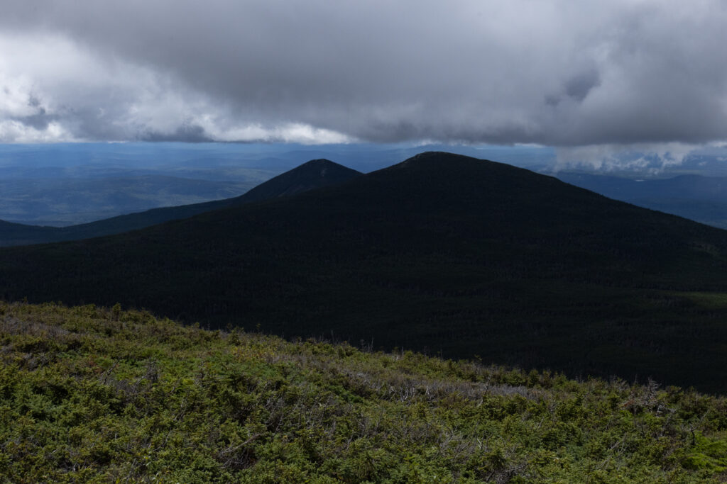
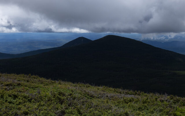
NORTH BROTHER MOUNTAIN — Clouds hover over Katahdin as seen from the top of North Brother Mountain on Aug. 22 in Baxter State Park.
In Baxter State Park, Katahdin and The Brothers are among 40-plus peaks and ridges that you can explore on more than 220 miles of trails. Each summer, my family camps in the park, and I make it my mission to explore different trails. Perhaps someday I’ll have hiked them all.
The Brothers loop is one of the most challenging day hikes in the park, measuring more than 10 miles long and visiting three major peaks. It’s also particularly rugged, with plenty of exposed tree roots and rocks.
Just a bit south, Mount Coe, which is 3,795 feet above sea level, is a part of the loop. In fact, Mount Coe used to be considered one of The Brothers. On old maps, the three peaks were referred to as “The Three Brothers,” according to the book “Mountains of Maine: Intriguing Stories Behind Their Names” by Steve Pinkham. (By now, my copy of the book is well-worn from my frequent leafing.)
While Pinkham doesn’t share where the “The Brothers” name originated, he suggests that Mount Coe was named in honor of Ebenezer Coe, an engineer in the mid-1800s. He built a lock system between Chamberlain Lake and Eagle Lake and established Chamberlain Farm to service the many lumber camps in the region.
In addition, Mount OJI and West Peak are connected to the loop by the little-used OJI Link trail. I’ve never attempted to tack on those peaks as a part of the hike. That’d be an exceptionally long day.
I first hiked The Brothers in 2012 with a small group of family and friends. I recall running into a flock of spruce grouse on that hike. They were loitering on a section of trail high up in the mountains. Protected in Maine, these birds look and act a bit like chickens. They’re so uninterested in humans that often you can walk right up to them.
Coincidentally, a hiker went missing on The Brothers loop trail later that year. He was lost for three days before he was spotted by helicopter and rescued. The event reminded me that it’s easy to get lost in that dense forest.
I revisited the challenging hike this summer, walking through rain, sunshine and everything in between. It was a fantastically moody day. Dark clouds shifted over the landscape, with the sun fighting through now and again.
The hike starts at a small parking lot off the park’s Tote Road, near Slide Dam Picnic Area. I’ve never seen the parking lot full. During my recent hike, only two other cars were there.
You begin by climbing steadily uphill on the Marston Trail, which splits into the loop after 1.3 miles. From there, I suggest turning right to hike to the top of Mount Coe first.This section of trail includes a long and frankly ridiculous slope of bare granite called the Coe Slide. It’s usually easier and safer to hike up steep slopes rather than down them.
If it’s raining, you may want to forgo Mount Coe altogether because the slide is treacherous when wet. In that case, turn left at the start of the loop and head to North Brother for an out-and-back hike. You can’t complete the loop without traversing the slide.
During my recent hike, I braved Mount Coe and slowly navigated up the slide, careful not to slip. Above it, I encountered sections of trail that were overgrown, with spiky spruce boughs crowding the path. I remember that being the case back in 2012, as well.
As I worked through the dense growth, I continually brushed up against the trees. Before long, my clothes were soaked from raindrops that had been clinging to the branches. Fortunately I packed a back-up set of clothes, which I changed into when the trail opened back up.
The view from the summit of Mount Coe is spectacular, so I hear. Clouds engulfed the top of the mountain on both occasions I had to stand there. Perhaps Coe has a sense of humor.
With clouds looming overhead and intermittent rain showers dousing the forest, I decided to pass by the 0.3-mile side trail leading to the top of South Brother. Instead, I continued on the loop to the 0.8-mile side trail leading to the top of North Brother. My hope was that, by the time I reached the mountain’s top, the clouds would clear — and they did.
On the open summit, long grass danced in the warm wind, the blades whispering a song. As clouds shuffled across the sky, they cast deep shadows on the landscape below. But atop North Brother, I stood in the sun.
For those looking for a challenging hike that feels remote and little-traveled, I highly suggest The Brothers. In the shadow of Katahdin, they don’t see many visitors, but they offer some of the finest views in the park.