Once-dry Piscataquis River reaches flood stage in early week storm
By Ernie Clark, Bangor Daily News Staff
Barely two months after registering date records for lowest daily water flow in late September, the Piscataquis River was at flood stage on Tuesday afternoon.
The river was reported to be at 11.9 feet as of 11:30 a.m., with flood stage for the waterway northwest of Dover-Foxcroft at 11.0 feet, according to a flood warning issued by the National Weather Service office in Caribou.
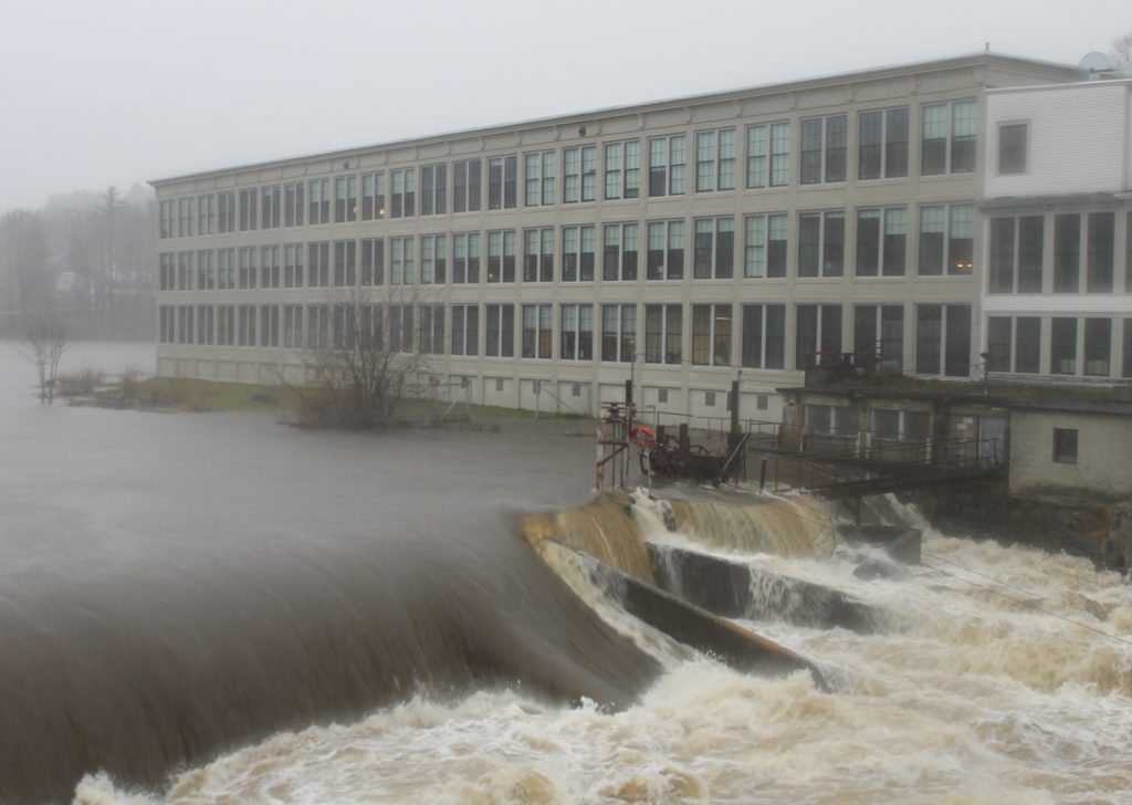
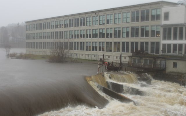
RISING WATER — The Piscataquis River rises by The Mill at Dover-Foxcroft, the former Moosehead Manufacturing facility, late Tuesday morning. The river crested above flood stage.
The river is expected to crest at 12.4 feet by 7 p.m., then drop below flood stage later Tuesday evening as a 24-hour rainstorm that drenched the area with between 3 and 4 inches of precipitation abated.
The NWS reported that the river was flowing at a rate of 12,000 cubic feet per second by the measuring gauge at Low’s Bridge just off Route 15 in Guilford late Tuesday morning.
That’s equivalent to 89,766 gallons per second, and in stark contrast to the flow rate recorded at the same location on both Sept. 24 and Sept. 29, when the drought-stricken river experienced its lowest flows of the year at just 5.5 cubic feet per second.
That rate narrowly missed the river’s record-low stream flow for any date of 5.0 cubic feet per second measured in 1905.
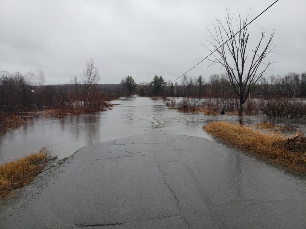
ROAD CLOSED — Water from the swollen Piscataquis River floods the Back Road in Abbot, causing its closure on Tuesday.
The river established daily date records for low flow throughout the latter half of September, according to Nick Stasulis, chief of hydrologic surveillance for the U.S. Geological Survey’s Maine Water Science Center in Augusta.
The river’s flood stage stemmed from heavy rain that had fallen in southern Piscataquis County from late Monday afternoon through noon Tuesday, and was evident in numerous locations along a 12-mile stretch of Route 15 between Abbot and Dover-Foxcroft.
The river’s fast-moving water flooded the Back Road in Abbot, forcing its closure.
It also flooded part of the outfield at Gaw Field, a baseball diamond along Route 15 in Guilford, and closed in on several homes along lower Lincoln Street in Dover-Foxcroft.