Unseasonal warmth led to record-breaking storm
By Lori Valigra, Bangor Daily News Staff
Warmer temperatures near the ground in Maine helped create unusually high winds on Monday, Dec. 18 — up to 93 mph in one area of the state — that caused some of the highest power outage numbers on record.
Temperatures rose into the 50s on average across Maine, which is unseasonably high compared with the mid-20s and low 30s typical of this time of year. The warmer air, which is lighter than cold air, allowed strong winds from the atmosphere to push to the ground, according to Derek Schroeter, a meteorologist with the National Weather Service in Gray. Colder temperatures near the ground normally would have kept the winds aloft, he said, because colder air is denser.
It would be difficult to directly link climate change as a cause of this or any one particular storm, he said, because it is measured over long periods of time. But storms are getting more frequent and severe because of warming air and water temperatures that come with climate change.
This year may end up being the warmest on record for the planet, with November 2022 through October 2023 being the hottest 12 months, according to Climate Central.

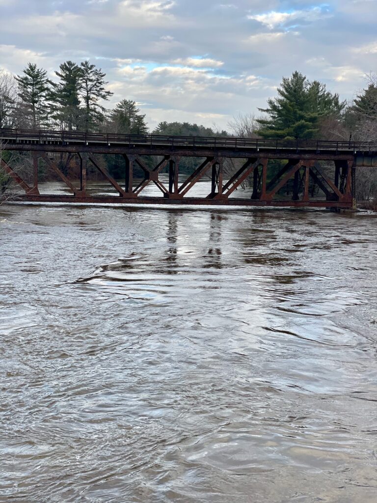
FLOODING — The Pleasant River flooded portions of Brownville Junction on Dec. 19.
“We need to accumulate data over a long period of time and then look at the trends in that data,” he said.
Wind data can vary greatly from location to location. The highest gust recorded during the storm was in Trescott at 93 mph. Bangor hit 71 mph, Augusta 68 mph and the Portland Jetport 60 mph, he said. Hurricane-force winds occur at 74 mph.
The highest wind gust in Trescott, a town in Washington County, was more severe than the peak gusts of 60 to 70 mph in the October 2017 windstorm throughout Piscataquis, Penobscot, Washington, and Hancock counties, morning coordination meteorologist Louise Fode of the National Weather Service in Caribou said. Power outages in the four-county area peaked at about 125,000 in this storm compared with about 100,000 in the October 2017 storm, she said.
Increasing greenhouse gasses in the atmosphere are trapping more heat, which also gets absorbed by the ocean, said Sean Birkel, the Maine state climatologist and an assistant professor in the University of Maine’s Climate Change Institute. Every one degree of heat in the atmosphere can hold about 4 percent more water in each unit of area, creating a greater potential for heavy rainfall or snow and wind.
The warm air originated in a storm that developed off the east coast of Florida and moved up the coast, causing trees to fall and roads to flood in its wake. Birkel said it was an unusually humid air mass for this time of year.
The storm is indicative of the types of weather events being seen across the U.S., especially in the Midwest and Northeast, said Jeremy Porter, head of climate implications at the nonprofit climate data company First Street Foundation in Brooklyn, New York.
“As climate change happens, we’re seeing more extreme precipitation events and stronger storms,” he said.
Dec. 18’s storm caused 97,000 outages at its peak for Versant Power customers, the highest on record, spokesperson Judy Long said. Last December’s ice and snowstorm caused 72,500 outages at its peak for Versant, and the October 2017 windstorm, previously the strongest, caused 87,754.
Central Maine Power reported a peak of 423,600 outages during the storm, less than the 467,200 in the October 2017 windstorm but more than the 415,000 during the 1998 ice storm across its service area.
The restoration effort for the storm is the largest in CMP’s history, however, spokesperson Dustin Wlodkowski said. The wind caused more of a mess than usual because heavy rains saturated the ground during the storm, causing trees to collapse.
CMP spokesperson Jonathan Breed said part of CMP’s ability to move quickly is that it received several hundred transformers before the storm from Iberdrola, the Spanish company that owns CMP’s parent, Avangrid. The transformers had been under supply chain shortages during most of the COVID-19 pandemic.
“Business as usual doesn’t really cut it anymore,” Porter of First Street said. “We have to understand that the types of storms, and the types of events that we’re getting, are more extreme, more volatile, and we just need to be more proactive in understanding that something that seems like a mundane seasonal storm could have the potential to bring lots of damage.”
Lori Valigra is an investigative environment reporter for the BDN’s Maine Focus team. She may be reached at lvaligra@bangordailynews.com.Support for this reporting is provided by the Unity Foundation and donations by BDN readers.