What to know about hiking Maine’s tallest volcanic mountain
Standing on the summit, surrounded by jagged hunks of rock, I looked out over a seemingly endless forest of crimson, gold and burnt orange foliage. Beside me, a weathered wooden sign read, “The Traveler — 3,541 feet, Maine’s tallest volcanic mountain.”
Fall had arrived in Baxter State Park, and I was celebrating with a 10-plus-mile hike of the Traveler Range. Visiting multiple peaks, it is one of the most challenging day hikes in Maine. It’s also particularly interesting, geologically.
The Traveler Mountain Range is underlain with rhyolite, thick deposits of volcanic ash fused together under extreme heat and pressure. This formed from volcanic eruptions, but don’t worry, the system was last active in the Early Devonian Period, about 400 million years ago, before the time of the dinosaurs.
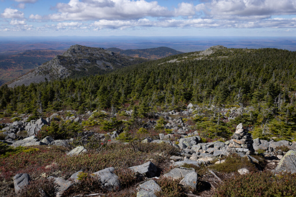
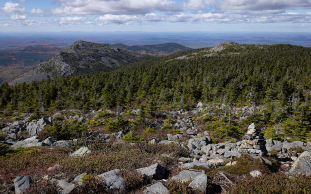
TRAVELER MOUNTAIN RANGE — A rock pile called a cairn marks a hiking trail that visits all the high points on the Traveler Mountain Range in Baxter State Park.
In contrast, most of Maine’s mountains are made of granite, which is a rock that forms from magma as it cools deep within the Earth’s crust. Granite, while igneous — made of magma or lava — is not considered volcanic.
Researching for this column transported me back to grade school earth science class, and I didn’t mind it one bit.
Maine has other mountains made of volcanic rock, but none as tall as Traveler. One of the most famous is Mount Kineo, a dramatic monolith that rises up out of Moosehead Lake. That mountain’s flint-like rhyolite was long prized by the area’s indigenous people as material for crafting tools and arrowheads.
You see, rhyolite, being so fine-grained, breaks into smooth, curving lines that can be sharp, like glass. For this reason, you might want to wear rugged boots with thick soles when hiking over it.
My hike of the Traveler loop began at South Branch Pond Campground, which is usually accessed from the north entrance of the park. As I passed through the entrance gate, a ranger asked what I knew about the hike.
“It’s very tough,” I replied. “Like Katahdin.”
That seemed to put the ranger at ease. I think she was concerned that I might not know how strenuous of a hike it was. It’s estimated to take the average hiker 8-10 hours, with an elevation gain of about 3,700 feet. That’s only a few hundred feet less than climbing Katahdin, Maine’s tallest mountain.
However, in my opinion, the real challenge of the Traveler loop isn’t physical, it’s mental.
The trail travels over three major peaks – North Traveler, Traveler and Peak of the Ridges – dipping down in between. It also visits bumps in the ridge that hikers call “false peaks,” and this can be maddening. Just when you think you’ve reached a summit, a stretch of more uphill climbing unfolds. And when you’re descending into a dip between peaks, each step down means an eventual step up.
You have to be prepared for this up-and-down journey.
The trail is also incredibly rugged and primitive, which is taxing for both the body and the mind. Due to uneven and often tippy rocks, you have to constantly watch your footing and exercise care.
In addition, the blazes and cairns that mark the trail are spaced far apart in some areas, which means you have to be extra careful not to wander off the trail.
As is the case with all challenging day hikes, it’s important that you carry the necessary survival gear and wear appropriate clothing. A headlamp, first aid kit, trail map, waterproof matches and extra warm clothing were among the items stuffed in my pack, along with plenty of snacks and water.
As I hiked the route, I kept an eye out for interesting rock formations.
Traveler rhyolite comes in various shades of gray, sometimes tinged blue and green, according to an online document about the formation published by the Maine Geological Survey. When exposed to the elements, the rock can weather in a way that makes it appear light gray or even white. In addition, iron often stains it brown or red.
When sheets of igneous rock cool rapidly, as it did to form Traveler rhyolite, it develops fractures as it solidifies and shrinks. The pattern of those fractures often produce four-sided to eight-sided columns, which almost appear manmade.
You pass a great example of this on the trail leading up North Traveler Mountain. It can also be seen decorating entire cliff faces of the mountain range.
Though the mountain range is special geologically and offers amazing views of the park, it wasn’t until 2005 that the few trails on it were connected to form a 10-mile loop hike starting at South Branch Pond, according to “Mountains of Maine: Intriguing Stories Behind Their Names” by Steve Pinkham.
The book also states that the long, multi-peaked Traveler Range was named such by trappers, explorers and loggers. While canoeing on rivers and ponds to the east, they noticed that the range appeared to travel with them.
“It was not until they had traveled many miles that the mountain finally began to recede into the distance,” Pinkham wrote. “Therefore, the name Traveler seemed appropriate.”
As I hiked the range, I started to suspect it was moving with me like a hamster wheel. As the rocky hills rolled on and on, I wondered if I’d ever make it around the loop. Perhaps I’d be stuck above the treeline, picking my way over wobbly rocks, forever.
But I did make it — across the expansive rockslide and a thin spine known as Little Knife Edge, through an enchanting stand of white birches near the top of North Traveler, over narrow bog bridges and down steep, rocky slopes.
With a sunburned nose and a belly full of trail mix, I finished the hike, signed out of the trail register and waved goodbye to Maine’s tallest volcanic mountain.