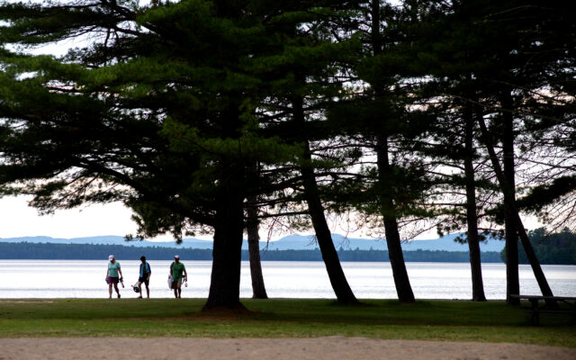
Nearly 1,800 acres around Moosehead identified for future housing and business development
The Maine Land Use Planning Commission and members of the public have defined an area of the Moosehead Lake region that could be used for future housing and commercial development.
Nearly 1,800 acres of land, or six development zones spanning four townships, are proposed for development, said Stacie Beyer, the planning commission’s acting executive director. This is about 11 percent of the 16,910 acres designated for development in the controversial Plum Creek project, a zoning plan proposed in 2005 that was meant to bring two resorts, 1,000 second-home lots, a golf course and other attractions to the area.
After more than a decade of the Moosehead Lake region awaiting new jobs and a revitalized economy, the Plum Creek’s Moosehead Lake Region Concept Plan was terminated in 2020 by Weyerhaeuser Co. A timberland company and real estate investment trust with headquarters in Seattle, Washington, Weyerhaeuser purchased Plum Creek Timber Co. in 2016. It turned the process over to the state and residents to determine future use of the land, Beyer said. Since summer 2020, the planning commission has been meeting with the public on what it wants to see happen to the land.
The effort, called the Moosehead Regional Planning Project, entered an important phase last week, when planning commission staff presented a draft package outlining recommendations for land use based on input from Piscataquis County residents. Now a picture is starting to emerge, showing areas that could see development and those that are likely to remain untouched to preserve the natural beauty and wildlife of the region.
The six development zones are proposed for Beaver Cove, Big Moose Township, Long Pond Township and Taunton and Raynham Academy Grant. The locations were designated as development areas under the Plum Creek plan, and they are proposed as either general development or residential subdistricts in the latest project.
That means a combination of residential and commercial development could unfold there, Beyer said.
They are located near what the planning commission calls “rural hubs.” There was strong consensus among residents and other stakeholders that development should be concentrated near existing development centers, according to an April update on the project. Planning commission staff had previously provided four discussion scenarios to the public and then collected feedback.
Planning commission staff also recommended removing 10 townships from primary and secondary locations, including Big Moose Township, Long Pond Township and Sapling Township. The move would minimize the intensity of future development and focus it in the rural hubs.
The public had concerns about future development around Indian Pond, Long Pond and Brassua Lake, so the package proposed removing most of the area around those bodies of water.
The Natural Resources Council of Maine, an Augusta-based nonprofit dedicated to protecting the state’s environment, finds the planning commission’s recommendations encouraging, Forests and Wildlife Director Melanie Sturm said. The group is pleased with the recommendation to rezone Lily Bay Township because it decreases the likelihood of future housing or a resort like the one proposed by Plum Creek.
The plan balances the need for economic development opportunities in the area with conservation of natural resources and protection of scenic character, she said.
The organization may suggest that additional townships be removed from development consideration and that some areas be designated as protection zones, such as Brassua Lake’s peninsula, Sturm said.
Since the start of the process, the planning commission has involved the public in various ways, including in-person and virtual meetings, written comments, surveys and phone calls, Beyer said. At one point a map-based digital survey was made available, and more than 350 responses came in, she said.
“I think it’s a combination of local interest groups, interested persons in the area and statewide groups,” she said. “It’s been very broad in terms of the comments that we have received.”
Now that the planning commission has narrowed its recommendations, public meetings will be scheduled for this summer, and feedback will guide staff members as they make revisions.
The commission will consider rule revisions and the adoption of new maps before the end of the year, according to the planning commission’s timeline for the project. If new zoning and rule amendments are approved, they would likely go into effect in early 2023.