This Texas hike revealed a surprising connection to Maine’s mountains
By Carey Kish
Standing on a mountain in West Texas, I wasn’t expecting to think about Maine.
But buried deep beneath my feet was a geologic connection to the Appalachian Mountains. The same ancient range that defines much of our state.
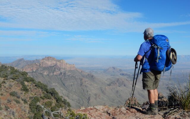
I had just hiked six miles up through piñon pine and juniper to the South Rim of the Chisos Mountains in Big Bend National Park. At 7,300 feet, the view stretched across the Chihuahuan Desert to the Rio Grande, where it cuts between towering limestone walls along the U.S.-Mexico border.
It felt like one of those top-of-the-world places, the kind of view you might compare to Katahdin, where the scale and wildness stop you in your tracks.
But what I couldn’t see was even more remarkable.
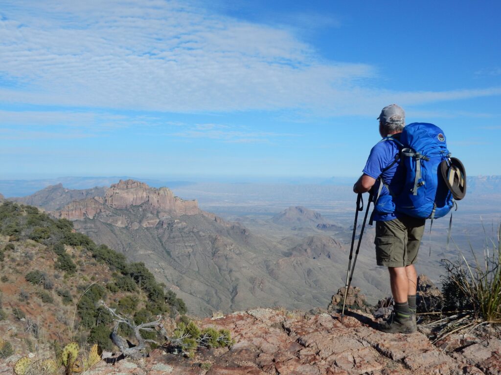
SOUTH RIM — The author stands on the South Rim in Big Bend National Park, overlooking miles of desert stretching into Mexico.
Deep below the desert landscape lies an ancient extension of the same mountain-building forces that created the Appalachians. Long before Maine, Texas and the rest of North America looked anything like they do today, they were part of the same landmass — and the same mountain system.
That realization hit just as hard as the view.
Big Bend National Park spans more than 800,000 acres along a dramatic bend in the Rio Grande. The Chisos Mountains rise at its center — a green island in a sea of desert. Trails wind through rugged peaks, down into canyons and across dry washes, offering a kind of remote, wide-open experience that’s hard to find anywhere else in the country.
I was introduced to the region years ago by my wife, a former river guide who spent winters here earlier in her life. On my first trip, we paddled stretches of the Rio Grande, backpacked along the South Rim and explored trails that seemed to disappear into the desert.
I was hooked.
Since then, I’ve returned several times to hike deeper into both Big Bend National Park and neighboring Big Bend Ranch State Park, logging miles on trails that range from well-marked routes to old wagon paths and remote backcountry loops.
But it wasn’t until one of those early visits that I stumbled onto the connection to Maine.
For most of my life, I thought of the Appalachian Mountains as a range that stretched from Georgia to Maine. After hiking the Appalachian Trail decades ago, I figured I had seen the full extent of it.
Then I learned otherwise.
The Appalachians don’t end in Maine. They continue into Canada, all the way to Newfoundland. And beyond that, their remnants stretch across the Atlantic into parts of Europe and North Africa.
The reason goes back to Pangea, the supercontinent that formed roughly 250 million years ago when Earth’s landmasses collided into one. The Appalachian Mountains were created during that collision, making them among the oldest mountain systems on the planet.
When Pangea began to split apart millions of years later, those mountains were broken and scattered across what would become separate continents.
And some of that story extends all the way to Texas.
During a visit to a park visitor center, I came across an exhibit that stopped me cold.
It explained that a now-vanished mountain range, known as the Ouachita Mountains, once extended through parts of what are now Alabama, Mississippi, Arkansas, Oklahoma, Texas and into Mexico. These mountains were formed during the same tectonic events that built the Appalachians.
Over time, erosion wore them down, and later geologic forces reshaped the region into the landscape seen today. What remains of that ancient system is mostly hidden, but fragments still exist in places like Arkansas, Oklahoma and parts of West Texas.
In other words, the ground beneath Big Bend is tied, in a very real way, to the same deep geologic history as the mountains back home.
Standing on that ridge above the desert, looking out across a landscape that feels worlds away from Maine, it’s hard to wrap your head around that kind of connection.
But it’s there.
The same forces that lifted the Appalachians also shaped what lies beneath the desert floor.
You just can’t see it unless you know where to look.
Since that trip, I’ve found myself thinking about that connection more often.
Next time I’m standing on Katahdin or walking a familiar trail closer to home, I’ll remember that the story beneath my feet doesn’t stop at the horizon, or even at the edge of the state.
It stretches far beyond, across continents and time, linking places that seem to have nothing in common.
Sometimes, it takes a hike in the middle of a Texas desert to make you see Maine a little differently.