Hike the tallest mountain in Maine’s 100-Mile Wilderness for stunning views
By Aislinn Sarnacki
In the shade of stunted spruce trees, mounds of snow slowly melted in the warmth of late May. We were nearing the top of Whitecap Mountain, the tallest peak in Maine’s 100-Mile Wilderness, and I was eager to see the celebrated views for myself.
The mountain had been on my list of places to hike for years. I once tried to find the trailhead and instead got lost on a network of bumpy logging roads. Afterward, a bunch of helpful Bangor Daily News readers offered me detailed directions to the trail, but I never got around to giving it another try — until last week.
I was making hiking plans with my friend Tori Gray, and she mentioned wanting to explore Map 42 of the Delorme Maine Atlas and Gazetteer. I flipped through my copy of the atlas to find Whitecap staring back at me. It was a sign.
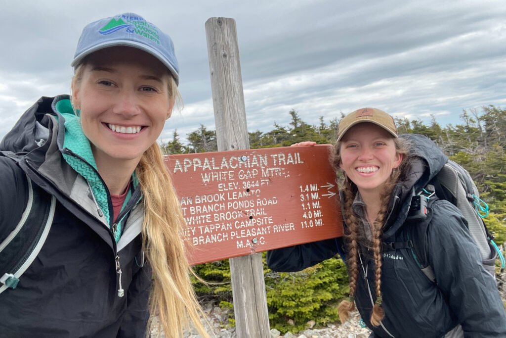
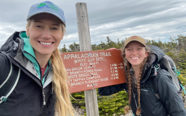
SUMMIT — Bangor Daily News Outdoors contributor Aislinn Sarnacki, left, and Tori Gray pose for a selfie at the summit sign of Whitecap Mountain on May 27 in Maine’s 100-Mile Wilderness.
There are a few ways to hike Whitecap Mountain, which rises 3,644 feet above sea level. The Appalachian Trail, a famous footpath that spans from Maine to Georgia, travels up and over the mountain. Then there’s the White Brook Trail, a side trail that approaches the mountain from the southwest to connect to the Appalachian Trail about a mile from Whitecap’s summit. That’s the trailhead that had eluded me so many years ago.
Tori, a fellow Maine guide, was up for an adventure. So we headed for the Katahdin Ironworks gate, where we registered and paid a fee of $12 per person (cash only) for a day in the North Maine Woods. Using a DeLorme Atlas and Gazetteer and driving directions from the “Appalachian Mountain Club Maine Mountain Guide,” we slowly navigated logging roads and went right past the trailhead.
Fortunately, it didn’t take us long to realize our mistake. A new logging road had thrown us off, and there was no trailhead sign or official parking area.
Using my Delorme InReach, a handheld GPS device, we verified that an old, overgrown logging road that we’d passed was indeed the start of our hike. So we backtracked, parked off the road (so not to block traffic) and started walking toward the mountain.
Moose prints, pressed into the soft earth, marched along the overgrown road. We came upon piles of moose poop at regular intervals, telling us the route was somewhat of a moose thoroughfare.
We crossed several brooks, including one with a small waterfall. To avoid swamping our boots, we leapt rock to rock, careful not to slip. In one case, we bushwhacked down the brook a short distance to find a better way to cross.
Eventually, the road narrowed into a trail, and we spotted a trail marker, a blue blaze, painted on a rock. Over plenty of rocks and roots, we hiked steadily uphill, confident we were on the right track.
Tori and I had a lot to talk about, which I think made the hike seem a lot shorter and easier. We also stopped from time to time to inspect various plants and mushrooms or just marvel at the beauty of the forest. Like me, Tori is fascinated by nature, and she shares that excitement through her guide company, The Wilderness Guru.
Reaching the Appalachian Trail was a moment of triumph. From there on out, the trail was marked with the recognizable white AT blazes. Spanning roughly 2,190 miles, the AT is one of the most famous trails in the world, and its northern end is atop Katahdin, Maine’s tallest mountain. Hiking even a short section of the trail is a special experience in my book.
Near the top of the mountain, snow clogged the trail, reaching more than two feet high in some places. The shadow of the dense alpine forest had sheltered the area from the sun. But it was just for a couple hundred feet. Then we were back to walking over roots and rocks.
The trees became shorter and shorter as we approached the peak. All of a sudden, we could see over their needled branches to the surrounding wilderness of lakes and mountains.
A sign marked the summit. A group of hikers, the first we’d seen all day, were eating lunch nearby, enjoying open views to the south. The mound of Big Spruce Mountain stood closeby, while a line of mountains — Chairback, Columbus, Third and Fourth — stood farther away.
To give them space, we took a side trail to a nearby overlook. This one faced northwest, where Katahdin stood tall. On a rock at the overlook, a white “K” had been painted, plus an arrow pointing toward the famous mountain. I’ve heard that this view atop Whitecap can be an important spot for AT thru-hikers headed north. It’s where they get a good look at the mountain that marks the end of their long journey.
After eating lunch and spending plenty of time enjoying the views, Tori and I headed down the mountain the way we’d come. Out and back, the hike was about 6.5 miles. To cap off an awesome day, we headed to Millinocket for pizza at Knife Edge Brewing. I suggest checking it out if you’re ever in the area — perhaps after a nice, long hike.
Is there a mountain that’s been on your “to hike” list for a while? Maybe now’s the time.