We hiked to one of Maine’s hardest to reach summits
By Ron Chase
On the third day of our six-day Baxter State Park expedition, eight of us awoke in the midst of a stormy Northeaster. We were occupying the bunkhouse at South Branch Pond in the northeast sector of the park. Five inches of fresh snow had accumulated, and mixed precipitation was predicted for the remainder of the day. An unwanted crust was forming on the snow.
The inclement weather limited safe outdoor options to lower elevation activities. Four of us decided to attempt a snowshoe climb to the top of 2,085-foot Barrel Ridge, located about 3 miles east. We had observed the elongated barren summit while climbing North Traveler Mountain the previous day.
Others in the group were considering skiing alternatives when we departed up South Branch Road toward the junction for Middle Fowler Trail a short distance north. After turning right onto Middle Fowler, breaking trail in the crusty snow was demanding. Light precipitation that varied between flurries and freezing rain continued as we advanced easterly on rolling terrain in a mixed hardwood and conifer forest.
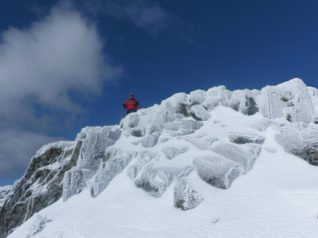
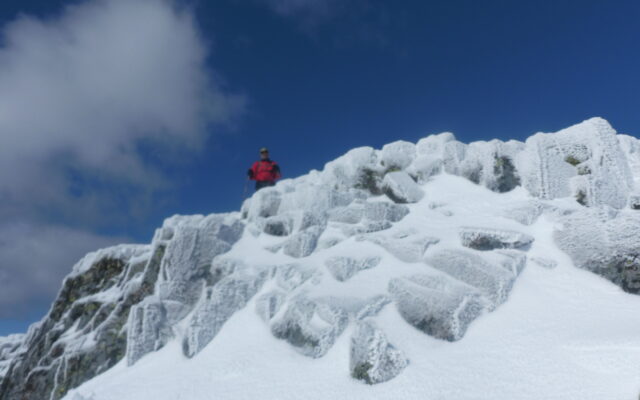
LOOKING DOWN — Enduring gusty winds, a climber peers down form the alpine-like summit in Baxter State Park.
At about 2.5 miles, the trail rose to an open escarpment that provided a foggy view of our destination. Beyond, the path dropped steeply into a ravine cluttered with blowdowns while we searched for a spur trail leading to the summit.
Signage for the summit trail was never located, but we soon began ascending steeply over snow-covered ledges on the south side of Barrel Ridge. Proceeding through a sparse conifer forest, we climbed to the top of the exposed rounded summit that provided glimpses of Grand Lake Matagamon in the distance. During our return, ski tracks that stopped just short of the blowdowns were proof that “trail poachers” had taken advantage of our snowshoe track.
While feasting on a delicious beef stew that evening, options for the following day were considered. A goal for several of us was to complete the famed Traveler Loop that traverses three summits, an 11-mile mountaineering challenge. Our first attempt via North Traveler Mountain the previous day had ended in failure at the summit of Traveler Mountain due to protracted trail-finding delays. This time, five of us would make an attempt in the opposite direction over Peak of the Ridges. Others had skiing on their minds.
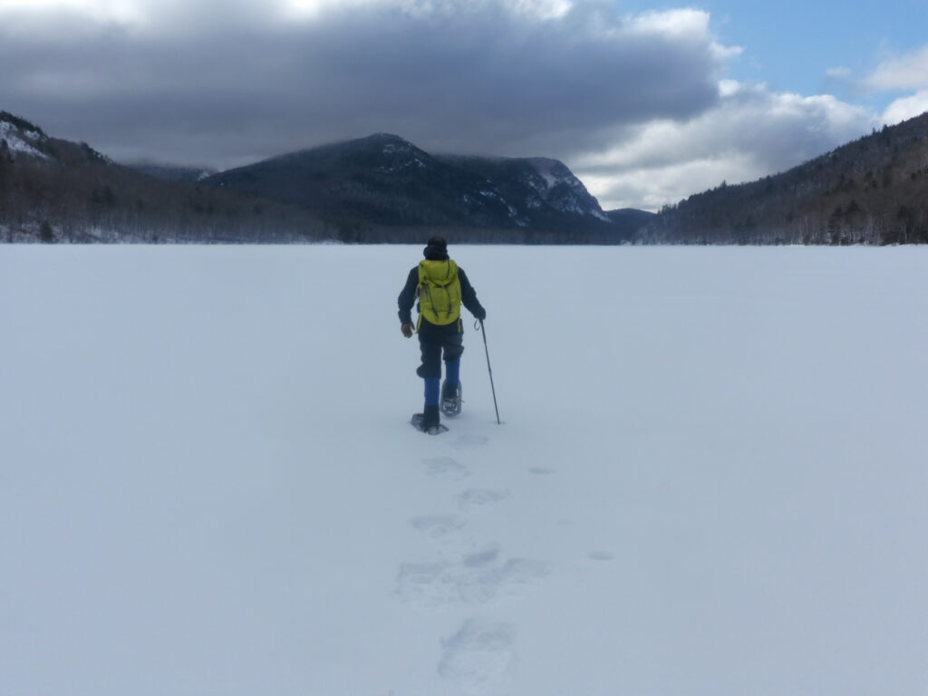
LOWER SOUTH BRANCH POND — A snowshoer crosses Lower South Branch Pond in Baxter State Park.
The weather was seasonably warm and skies partly sunny when we snowshoed across Lower South Branch Pond in search of Center Ridge Trail, a remote path that leads to 3,254-foot Peak of the Ridges. After traversing to Upper South Branch Pond, we bushwhacked east to Pogy Notch Trail and then climbed steeply to Center Ridge Trail.
From the outset, trail finding was very difficult in the precipitous rugged terrain. Progress was further hampered by arduous trail breaking in areas of deep snow. Advancing slowly, we finally emerged onto an exposed overlook that provided spectacular 360-degree views, a gratifying reward for our strenuous efforts. The distinctive summit of Peak of the Ridges seemed a long distance away.
Following a comparatively easy crossing of Center Ridge, we began our ascent of the predominantly barren summit cone. Unable to locate cairns or trail markings, we advanced steadily upwards while enduring gusty northwest winds towards a craggy rock formation that appeared to be the top. The prominence was a false summit but provided temporary shelter from the fierce gale.
We persisted to a massive boulder-pile that is the true summit, and the views from it were breathtaking. We found protection from the winds on the south side, getting an opportunity to consider our remaining agenda while enjoying a panoramic vista of the Katahdin Massif.
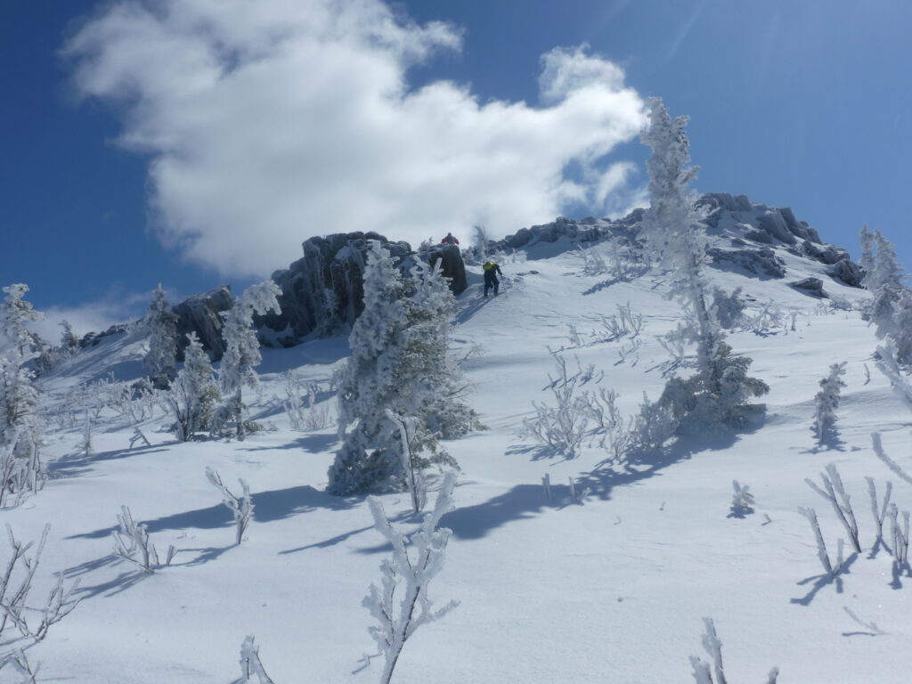
PEAK OF THE RIDGES — Climbers negotiate up Peak of the Ridges summit cone in Baxter State Park.
The 3.5-mile trek to the summit had taken us more than four hours. More than 7 miles remained to complete the loop, and the heavily forested saddle between Peak of the Ridges and Traveler Mountain would undoubtedly entail more trail-finding difficulties. We unanimously decided to forego our loop attempt. Lingering at one of the finest, most inaccessible mountain settings in Maine was at least partial compensation for our disappointment.
Strong winds continued until we descended below the tree line. Deep sticky snow and the abrupt gradient resulted in burdensome traveling at lower elevations. The flat surface on the ponds was a welcome relief. The 7-mile journey took more than eight hours.
That night, more adventures were contemplated for the following day.
My book, “Maine Al Fresco: The Fifty Finest Outdoor Adventures in Maine,” narrates a successful winter traverse of the Traveler Loop.