Unveiling planned Saturday for Great Circle Trail on Nahmakanta Public Reserved Land
In celebration of National Public Lands Day on Saturday, Sept. 25, staff of the Maine Department of Agriculture, Conservation and Forestry’s Bureau of Parks and Lands are honoring the grand opening of the Great Circle Trail, a new 30-mile hiking trail loop on the Nahmakanta Public Reserved Land in the heart of the Katahdin Region. The Great Circle Trail connects the Turtle Ridge Loop, Debsconeag Loop trail, and the Appalachian Trail into one large network. The loop trail can be hiked in bite-sized sections or a multi-day adventure, utilizing eight remote campsites.
“The Great Circle Trail concept has been in the works since 2005, and I thank everyone who has contributed to this significant resource,” commented DACF Commissioner Amanda Beal. “The new Great Circle Trail is an exceptional opportunity for hikers of all abilities to get outdoors and experience our gorgeous Nahmakanta Public Reserved Land.”
“Our dedicated staff has shown great vision and commitment to developing what will surely become one of Maine’s top multi-day backpacking trips. This trail offers a fantastic hiking experience in a remote, beautiful setting away from the crowds on busier trails such as the 100-mile Wilderness, Bigelow Preserve, or Tumbledown Public Lands,” added BPL Director Andy Cutko.
Everyone is welcome to participate in guided hiked along short sections of the new Great Circle Trail loop, explaining the unique cultural and natural history of Nahmakanta Public Land. Meet at the new Katahdin View Trailhead (45.694686, -69.170821) on the Penobscot Pond Road on the Nahmakanta Unit starting at 10 a.m. RSVPs are requested by calling the BPL’s Bangor Office at 207-941-4412. Detailed directions will be supplied upon registration. This event is rain or shine.
The total length of the Great Circle Trail is 30 miles. This distance includes segments of multiple trails: 1) two sections of the AT (2.3 miles) are used with permission from the National Park Service and Maine Appalachian Trail Club, 2) 6.5 miles of the Debsconeag Backcountry and 3.7 miles of the Turtle Ridge backcountry trails are used if you opt for the shortest distance across these two stacked loop trail systems, 3) 14.3 miles of the newer, connector trail (all south of the AT; all built since 2005), as well as 4) 1.4 miles of road walking (two sections, to be moved off the road as soon as possible).
The trail is designed for foot travel; bikes and motorized use are not allowed. The difficulty rating of the GCT is moderate, occasionally strenuous, with rocks and roots in the trail tread being the major obstacles. However hikers travelling longer distances or the full loop should be experienced in backcountry camping, navigation and safety. The trail has been built to a USDA Forest Service hybrid Trail Class 1/2 standard (minimally to moderately developed). The Class 1 standard is used on level sections, with tread often not continuous due to rocks and roots, whereas steeper (sidehill) trail segments have more cut and fill tread surface and wider spots for passing. Both classes use native materials for tread, steps, stepping stones, and bridging. Trail junctions are signed with distances to the next major destination, elevation gains are given for mountainous terrain. There are plans for a few interpretive signs to be installed.
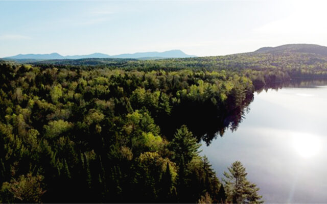
The difficulty of the trail is well-balanced by the rewards. Scenic trail features along the 30 miles of the Great Circle include four waterfalls, 11 remote ponds/lakes (seven with campsites), two gorges, and more than five panoramic views from ledges and overlooks.