Weather service says Hurricane Isaias could bring wind and heavy rain to Maine mid-week
The National Weather Service in Caribou has issued a hazardous weather outlook for much of Maine in anticipation of Hurricane Isaias’ arrival next week.
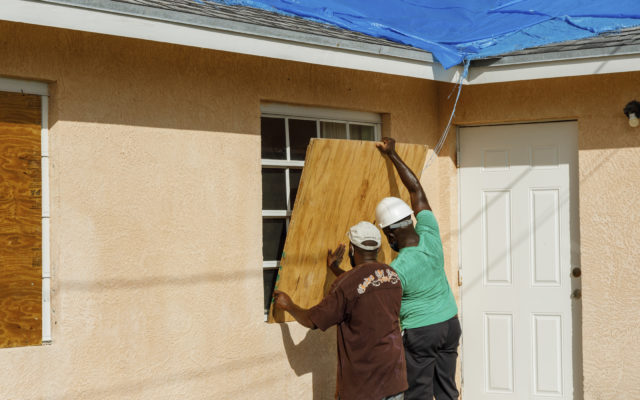
The hurricane, which ripped shingles off roofs and blew over trees as it carved its way through the Bahamas early Saturday and headed toward the Florida coast, was predicted to hit Maine mid-week.
“Exact impacts remain uncertain, but gusty winds and heavy rain will be possible,” the weather service said.
The hurricane or its remnants was expected to impact all but northern Penobscot, Somerset and Aroostook counties.
Isaias had maximum sustained winds of 85 mph Saturday morning and some strengthening was possible later Saturday, the U.S. National Hurricane Center in Miami said. The storm was centered about 50 miles south of Nassau in the Bahamas and was moving northwest at 12 mph. Forecasters said some decrease in its forward motion was expected.
A hurricane warning was in effect for Florida’s east coast from Boca Raton, just north of Miami, about 150 miles north to the Volusia-Flagler county line, according to the Associated Press. A hurricane watch was in effect from Hallendale Beach to south of Boca Raton.
Florida Gov. Ron DeSantis said the state was “fully prepared for this and any future storm during this hurricane season,” with stockpiles of personal protective equipment, generators, bottled water and meals ready to be distributed.
He urged people to have seven days of food, water and medication on hand and said state-run coronavirus testing sites in the areas where the storm could hit would be closed.
“Our sites, because they’re outdoors with tents, if it were to get 40-, 50-mile-per-hour winds, it would just collapse,” he said. “Safety is paramount for that.”